Road and Horse Network
From Dogcraft Wiki
(added video of christmas party) Tag: Visual edit |
mNo edit summary Tag: Visual edit |
||
| Line 87: | Line 87: | ||
No more than one signpost at an intersection, and no more than | No more than one signpost at an intersection, and no more than three stacked signs per signpost. | ||
|- | |- | ||
|[[File:RHN kilometer marker.png|left|thumb]] | |[[File:RHN kilometer marker.png|left|thumb]] | ||
Revision as of 13:16, 2 January 2021
| Road & Horse Network | |
|---|---|
| Survival 4 | |
RHN Logo | |
| Project | |
| Type | Server-wide Project |
| World(s) | Survival 4 (Husky) |
| Leader(s) |  _edo _edo |
The Road & Horse Network (RHN) is a group project focused on building and maintaining a network of roads across the Survival 4 Multiplayer worlds of the Dogcraft Server. The current network is mostly around the larger Husky spawn area, but ever expanding. The roads are a good way to travel around by horse, donkey, mule, foot or pig to visit all the connected cities, towns and player bases.
The RHN can be seen as the younger, smaller, and less organized nephew of the other travel networks: SRN (Survival Railway Network) and NTN (Nether Transport Network).
History
The project was first imagined as a semi-serious suggestion by  _edo (who also founded the SRN and the NTN) to add another discussion channel on the Discord SRN/NTN server, to talk about the planning and building of a road network that would go alongside the Survival Railway Network. Two roads, present-day Takeshi Road and Gaia Road, had already been built and there was potential for more. The suggestion was kindly dismissed, so instead, on July 14th, 2020, _edo started a new Discord server solely for the creation of a roads network, 3.5 months after the start of the Husky world.
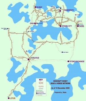
Since then, the RHN has steadily grown. As of December 2020, the RHN Discord server has 49 members, 10 of whom have actually built parts of the network, and the network of roads reaches up to 5k blocks away from spawn. Notably,  _Shako built a large section of the newer roads (Stone Exchange Road, Eagle Road, Lotus Isthmus Road, Flower Hills Road) and upgraded many of the older roads.
Builders
These players, often locals who have their residencies close to the roads, have built the RHN (as of 12 December 2020, in alphabetical order):
 _edo
_edo  _Shako
  ArchitectEagle
  expedtadam
  FangsofAmber
  IhopEnchiladas
  Kinda_lost
  LoLoBooM4k
  Montenator
  StenLLuk
What is built
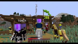
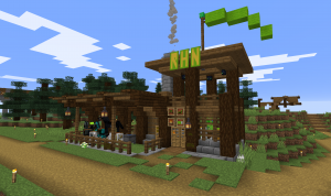
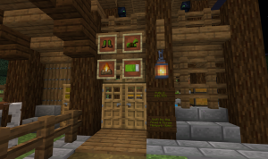
The built projects consist not only of public roads, but also many bridges, signposts, more than a dozen public shelters. In Spawn Town is the RHN Centre (view in map) which alongside public stables and shelter also has general info about the RHN, a shop selling everything needed for horse riding, a horse testing range, and more.
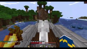
The RHN facilitates everything needed to make it easy and enjoyable for everyone to travel by horse (and also by donkey, mule, foot or pig).
Media
Gallery
Videos
How to participate
The RHN is an active, ongoing project. Everyone can help with building and maintaining the network! The best way is to join the RHN Discord server. Ask any of the above players in game for an invite, or search/ask for a public link on any of the other Dogcraft related Discord servers.
Design Guidelines |
|---|
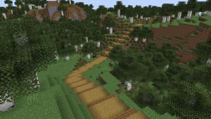
RoadsRHN roads need to be both passable and comfortable for horse traffic. This means the roads are at least three blocks wide with four blocks of clearance above. Most RHN roads however are four blocks wide, five blocks high. The most common surface materials used are grass path blocks and spruce slabs. Sometimes though, especially through settlements, other local styles are used. |
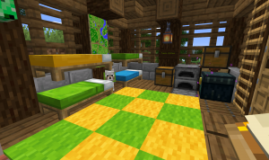
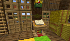
ShelterRHN Shelters provide the travel with a place to rest. It should be mob-safe. It needs stables to park a horse, beds, an ender chest, a public chest (players can leave food for others), a crafting table, a furnace, a lectern with a logbook for travellers to write their name and date of visiting, a small map of the local area. For recognisability, the shelter needs a lime green vane on a pole on its roof and the "RHN" banner letters, which can be acquired in the RHN Centre. Signs should be dark oak with lime green font.
|
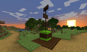
SignpostsDirectional signage, placed at each intersection of two thoroughfares, consists of dark oak signs stacked vertically, with white-colored text, placed on a lime concrete block surrounded by a dark oak plank base. Each sign provides directions to towns and bases along the route using arrows, text, and a number representing the number of kilometers (to the nearest 1/10) to the destination.
|
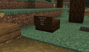
Kilometer markersKilometer markers, or "slab signs," are placed every 1/10-kilometer (100 blocks) along every RHN road and at each road's beginning and end points. They consist of a dark oak slab with a dark oak sign with white text. The four lines of text on each sign are as follows: ROAD NAME; NAME SUFFIX (e.g. ROAD, AVENUE); - DISTANCE - (e.g. - 1.7 -, - 2.4 -, - begin -); RHN. |
Road Documentation
The entire RHN system is documented on maps produced regularly by _Shako.
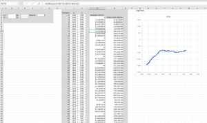
Road distances are measured by _Shako using a Microsoft Excel spreadsheet in which the coordinates of each vertex (or other change of direction) in a road's geometry are entered and a Pythagorean Theorem algorithm outputs the length of each segment and the cumulative distance for all of the entered segments. Every road has its own spreadsheet.
| ||||||||||||||
